Is the water in Xochimilco clean, and how deep is it?
How deep is it
Shallower than people expect, and inconsistent. The Programa de Manejo for the protected area, published in the Gaceta Oficial del Distrito Federal on 11 January 2006, gives about 60 cm in some canals and flooded ground, and 3 to 6 m in others. I have looked for a newer official survey and there is not one, so any page telling you “the canals are X metres deep” as a flat fact is quoting a 20-year-old document without saying so, or inventing. The boatman poles rather than rows for a reason.
Where the water comes from
This is the part that answers the cleanliness question better than any adjective. The springs and aquifer flow that historically fed the lake system — up to 10.8 cubic metres per second — were lost to groundwater extraction. What keeps the canals wet now is treated wastewater from three plants:
- Cerro de la Estrella — 2.01 m³/s, by a distance the largest contribution.
- San Luis Tlaxialtemalco — 0.060 m³/s.
- San Lorenzo Tezonco — 0.035 m³/s.
UNESCO, which inscribed the canals and chinampas as part of the “Historic Centre of Mexico City and Xochimilco” in 1987, names the same driver in its own threat language: the chinampa system is threatened by, among other things, excessive groundwater extraction and contamination.
What the published measurements say
| Study | What it measured |
|---|---|
| Salud Pública de México, 2003 | Treated effluents met the irrigation standard, but canal sites near sewage leaks substantially exceeded it. Antibiotic-resistant E. coli was isolated. |
| Freshwater Science, 2019 — four years of citizen-science monitoring across eight sites | Sites exceeded guidelines for pH above 9, total coliforms above 240 CFU per 100 mL, conductivity above 2,000 µS/cm and dissolved oxygen below 6.5 mg/L. One site met most guidelines — an area of abandoned chinampas. |
| PLOS ONE, 2025 | Untreated wastewater discharge and agricultural runoff are ongoing. |
| Programa de Manejo, 2006 | Eutrophication; heavy metals in the sediment — cadmium, lead, copper, chromium; aromatic hydrocarbons. |
Read the 2019 result closely, because it is the most useful thing on this page. Of eight monitored sites, the one that met most guidelines was a stretch of abandoned chinampas. Water quality here is not one number for one lagoon; it varies with what is discharging nearby.
What nobody publishes
I went looking for an official position on whether contact with the water is safe — SACMEX, SEDEMA, the Alcaldía Xochimilco, the city health authorities. There is none. Not a bathing advisory, not a contact warning, not a “do not touch” sign in a government document I could open.
So you will not read “authorities warn” on this page, because no authority has warned anything. You get the measurements above and your own judgment. For what it is worth, and this is a personal habit rather than any kind of instruction: I pole through these canals most mornings to reach my chinampas, and I keep my hands out of the water.
The 2020 rules for passengers already keep you out of it: stay seated, no standing at the bow or stern, hands and feet inboard, no jumping between boats. Your rubbish stays aboard too — and as somebody who farms alongside this water, I would ask you to take that one seriously.
If you want to be closer to the water than a trajinera puts you
A kayak sits you at the surface rather than on a bench a metre above it, which is worth knowing in both directions. The kayak option below runs 2.5 to 3.5 hours at sunrise or sunset and is not a trajinera at all; it is rated 4.8, but off 57 reviews, which is thin enough that I would read them rather than the average. The operator published no meeting point, so I cannot tell you which dock it leaves from.
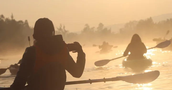
More on the wildlife the water still supports on the axolotl page, on the farming it feeds in what else there is to do, and on picking a dock in which embarcadero. The other things people mean when they ask whether Xochimilco is safe are on the safety page.
Frequently asked questions
Is the water in Xochimilco clean?
Published measurements are the honest answer, because no government body publishes a position on whether contact is safe. Four years of citizen-science monitoring reported in Freshwater Science in 2019 found sites exceeding guidelines for pH above 9, total coliforms above 240 CFU per 100 mL, conductivity above 2,000 microsiemens per cm and dissolved oxygen below 6.5 mg/L; one of eight sites met most guidelines, and it was an area of abandoned chinampas.
How deep is the water in Xochimilco?
The 2006 management programme for the protected area — the only official bathymetry I could find, and now 20 years old — gives about 60 cm in some canals and flooded areas and 3 to 6 m in others.
Where does the canal water come from?
Substantially from treated wastewater: Cerro de la Estrella contributes 2.01 cubic metres per second, San Luis Tlaxialtemalco 0.060 and San Lorenzo Tezonco 0.035. The historic spring and aquifer flow, up to 10.8 cubic metres per second, was lost to groundwater extraction.
Can you swim in the Xochimilco canals?
No authority publishes a position on contact with the water, so I will not invent one. The 2020 onboard rules do require passengers to stay seated with hands and feet inboard, with no standing at the bow or stern and no jumping between boats.